
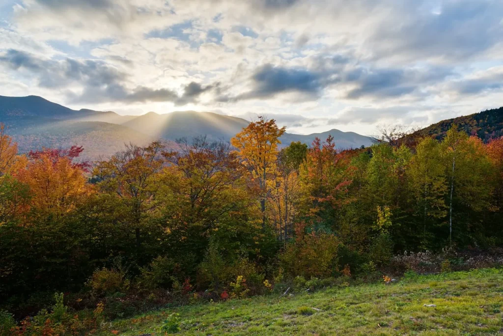

A one-day Kancamagus Highway drive is about choosing a few good stops, not parking at every viewpoint. This guide follows the scenic section of New Hampshire Route 112 from Lincoln east toward Conway. Allow a half day for a few overlooks and a short walk, or a full day with longer visits. The return journey is extra if you must finish in Lincoln. This is a road itinerary, not a rail or regular public-transport route.
MAKE YOUR BASE
Lincoln start; Conway finish, or allow a return drive
BEST TIME TO GO
Late spring–fall; winter conditions require different planning
GETTING AROUND
Car
Before the drive: Lincoln and supplies
Start in Lincoln with a full tank, water, food and an offline map. Check the White Mountain National Forest’s current alerts and recreation information, including any required day-use pass at selected sites. Do not assume cafés, fuel or reliable reception will be available throughout the scenic section. Decide whether you are making a one-way journey or returning to the same hotel; that determines how much time you can spend beyond the pass.
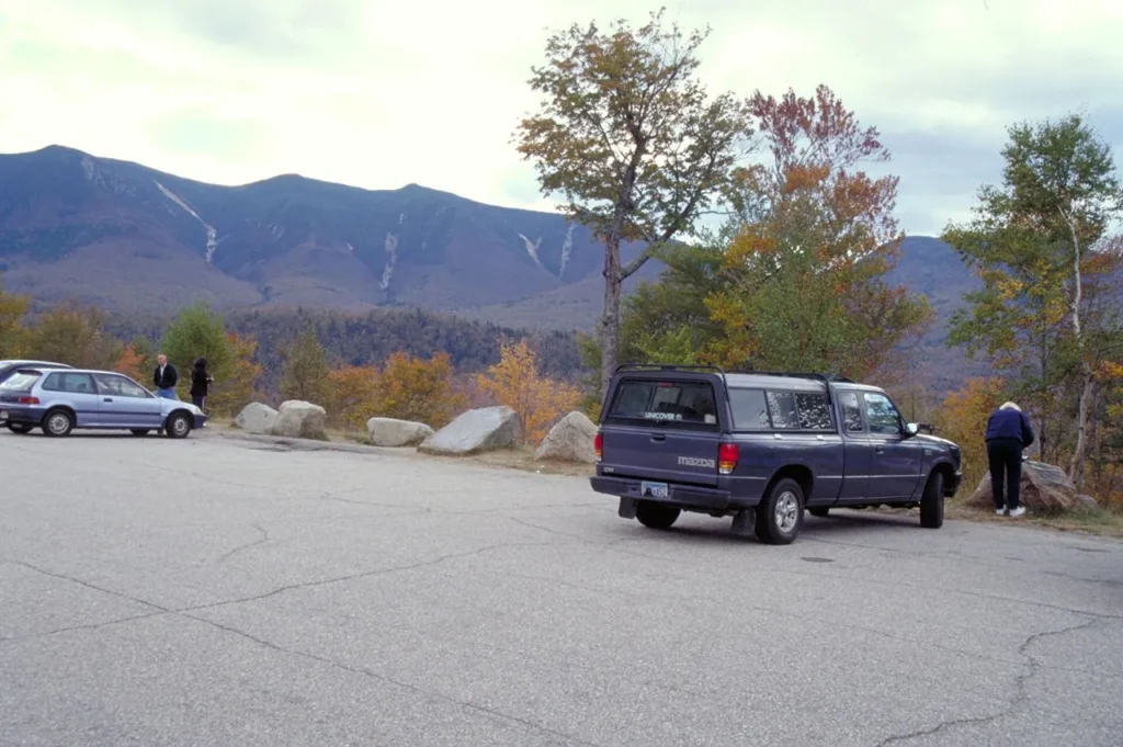

Western and central section: Select the overlooks
Drive east and use signed pullouts for views such as the Pemigewasset and other mountain overlooks as your direction and safe access allow. Stop only where parking is permitted, never in the travel lane or on a blind bend. One clear viewpoint is more satisfying than several hurried stops with similar scenery. In fall, allow extra time for queues and pedestrians around popular parking areas. Visibility can change quickly as the road climbs.
Eastern section: Choose a walk, then finish in Conway
Continue toward the eastern forest stops, selecting one location such as Sabbaday Falls or the Rocky Gorge area only after checking access and the route’s demands. Waterfalls and stream banks can have slippery rock, steps and uneven paths. Stay on signed approaches and do not treat scenic pools as safe swimming invitations. Leave time for a final pause around the Albany Covered Bridge area if it fits, then continue to Conway for food or your overnight base.
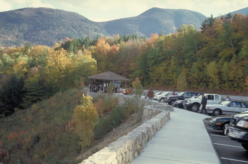

Good to know before you go
The scenic highway is roughly 35 miles, but mileage does not describe a sightseeing day. Stop duration, parking, foliage traffic and whether you retrace the route matter more than the driving-only estimate. A full itinerary with walks can easily occupy most of the daylight. If you start late, choose two viewpoints and omit the walk rather than finishing on an unfamiliar mountain road after dark. In poor weather, use lower-level stops or postpone; a fogbound overlook does not become more rewarding because it was on the plan. Bring warm layers and respect barriers, closures and no-parking signs.
For the wider regional plan, use the New England travel hub. Compare nearby options in the New Hampshire travel guide.
Decide whether this is a crossing or a return drive
The most important Kancamagus decision happens before the first viewpoint: are you going from Lincoln to Conway as part of a longer journey, or returning to the same side? The scenic road is roughly thirty-five miles, but an out-and-back day includes the return distance and any repeated sections. Write that into the schedule rather than treating the last planned stop as the end of the journey.
If staying in Lincoln, choose which eastbound stops matter most and keep the return simpler. If changing to an eastern base, make the crossing the principal daytime experience and arrive with time to check in and eat. If you are continuing a long distance after the scenic drive, reduce the number of stops. A day with a few unhurried viewpoints can be excellent; it does not need every pullout or an additional major mountain attraction to justify using a whole day.
Choose stops for variety and suitability
Select a mixture of landscapes rather than several places that offer nearly the same experience. A broad viewpoint, a river or waterfall area and one suitable short walk can provide enough variety. Use the current forest information for each named site, including parking, facilities and the route from the vehicle. The walk described as short may still contain roots, steps or wet rock.
For limited mobility, identify the exact viewing area and surface rather than relying on a general scenic-highway label. A roadside pullout and a trail-based viewpoint have different demands. Plan a clear turnaround on any out-and-back walk, and leave enough energy to return to the car. If parking is full, continue to another legitimate public stop instead of improvising roadside parking. The landscape is not improved by a hurried stop in an unsuitable location, and the day should remain flexible enough that missing one viewpoint does not feel like a failure.
Prepare for the services you will not have along the way
Start with fuel, drinking water, food and downloaded maps. The scenic section should not be approached as a town-to-town corridor with frequent places to buy whatever you forgot. Check current forest guidance for facilities and any applicable recreation fees before leaving the base. Carry a way to keep rubbish until you reach an appropriate disposal point.
Plan lunch as a deliberate break rather than a series of snacks while driving. Choose an appropriate public place and be prepared to change it if conditions or parking do not cooperate. Keep the driver’s attention on the road and let passengers manage navigation when possible. Pull over only where stopping is permitted and safe. If you need reliable phone access for an important commitment, arrange it before or after the scenic portion rather than assuming continuous coverage. A simple preparation list makes the day calmer and gives you more freedom to enjoy the places you selected.
Let weather shape the kind of scenery you pursue
Clear conditions can favor broad mountain views, while an overcast day may still suit a selected lower-level landscape stop. Heavy rain, poor visibility or wintry conditions can change whether the drive is sensible at all. Check the current forecast and road guidance for the actual travel date. Do not assume a summer route description applies unchanged to an autumn storm or winter day.
At rivers and waterfalls, remain on designated routes and avoid wet rock or entering moving water for a photograph. A short detour from the path can create more difficulty than the planned walk. Carry layers and footwear suitable for the stops you chose. If the weather deteriorates, shorten the sightseeing and return or continue by an appropriate route. The aim is an enjoyable scenic day, not a requirement to remain outside long enough to match the original schedule. A warm meal in the base town is a reasonable substitute for the final optional stop.
Keep autumn expectations and the onward journey realistic
Foliage timing depends on weather and elevation, so build the day around the landscape rather than a promise of peak color. Use current reports to refine a flexible plan, but do not turn the route into a race between uncertain claims. Busy autumn dates can make parking and lunch slower even when the road distance is modest. Leave spare time and accept that some stops may be better skipped.
Finish unfamiliar scenic sections in daylight where practical, particularly if you are tired or the conditions are unsettled. Calculate the final journey to the hotel or home separately from the sightseeing. Compare the day’s costs using fuel, any required fees, meals and the chosen accommodation base; an extra distant attraction may add more time than value. If you have another day, use it for a separate Franconia Notch or North Conway experience rather than cramming that attraction into the end of the drive. The Kancamagus can stand as the main event of a well-paced day.
Use a stop list with priorities, not fixed-minute targets
Before leaving, divide the selected stops into essential and optional. Give each essential stop a reason, such as the broad view or a particular suitable landscape walk. If two stops offer nearly the same experience, keep one optional. This makes it easier to respond when parking is full or the first walk takes longer than expected.
Avoid assigning a very short fixed allowance to every viewpoint. Getting safely parked, putting on a layer, walking to the view and returning all take time, and a place you enjoy may deserve longer. Use the lunch break to review the remaining daylight and return distance. If the day is running late, remove the optional walk rather than rushing on wet ground or sacrificing the entire meal. A scenic drive should allow you to stop because the place appeals to you, while still respecting the practical limits of the onward journey.
Budget for this route
October 2026 planning worksheet in US dollars: these are editorial spending allowances, not surveyed hotel rates, live quotes or guaranteed ticket prices. Price your actual dates before committing; peak weekends can exceed the room allowance.
| Item | Allowance | What to check |
|---|---|---|
| Meals, per adult per day | $45–$80 | Casual meals; alcohol and gratuities extra |
| Activities, per adult per sightseeing day | $20–$60 | An allowance, not the price of a specific ticket |
| Rental car and fuel, per vehicle per day | $90–$160 | Parking, tolls and rental coverage extra |
For two adults sharing transport, the illustrated sightseeing-day spending is $110–$220 per adult, before lodging and the exclusions above. No hotel is included in this day-trip estimate. Multiply nights and sightseeing days separately; arrival days need their own meals and transfers.
Price the expensive transport first: obtain a complete car quote for the pickup and return locations, then add each hotel’s overnight parking charge.
What to book, and in what order
Check Forest Service notices and recreation-site fees before setting off; this route is not a substitute for booking a separate attraction.
Next, confirm cancellation deadlines and the time you must report for any timed entry or departure. Leave meals and unbooked village stops flexible. Save tickets offline and avoid scheduling a non-refundable connection immediately after a weather-dependent outing.
Access, walking and places to pause
A roadside overlook can be a shorter alternative to a forest trail; inspect the actual path and turning space before leaving the car.
Before buying, ask the chosen venue for the entrance-to-main-attraction walking distance, surface and slope, stair count, working elevator or ramp, nearest restroom and seating on the actual route. For low-vision travelers, ask about audio description, large-print information and assistance locating the entrance. These are questions to confirm, not a claim that every listed service is available. Arrange a seated break after the main visit and keep an indoor alternative close to the overnight base.
Getting from your arrival point to the sights
Use a car or a booked driver for the corridor and agree the return arrangement; do not depend on obtaining a taxi at a turnout.
Save the exact pickup address and the provider’s contact details offline. Check the final return service before leaving the center; a map pin for a town is not a station exit or attraction entrance. If a ride is essential, confirm its availability and cost before making the reservation that depends on it.
Short on time? Keep these stops
For half a day, choose a few overlooks along one section and return with daylight.
Skip trail descents and side roads before sacrificing a safe return margin.
Check actual prices, calendars and access
Printable trip checklist
Kancamagus Highway in One Day: Stops in Driving Order
Use your browser’s print dialog to print the checklist or save a PDF. Fill in your own travel dates, reservations and quoted costs on the printed copy.
Overnight base: Lincoln start; Conway finish, or allow a return drive
Travel dates: ____________________ Booking references: ____________________
- Before the drive: Lincoln and supplies — Start in Lincoln with a full tank, water, food and an offline map.
- Western and central section: Select the overlooks — Drive east and use signed pullouts for views such as the Pemigewasset and other mountain overlooks as your direction and safe access allow.
- Eastern section: Choose a walk, then finish in Conway — Continue toward the eastern forest stops, selecting one location such as Sabbaday Falls or the Rocky Gorge area only after checking access and the route’s demands.
Area map links
Open these links in a saved PDF; on paper, use the place and state names to look them up. These are area searches, not verified entrances or turn-by-turn routes.
Before leaving
- Check Forest Service notices and recreation-site fees before setting off; this route is not a substitute for booking a separate attraction.
- Use a car or a booked driver for the corridor and agree the return arrangement; do not depend on obtaining a taxi at a turnout.
- A roadside overlook can be a shorter alternative to a forest trail; inspect the actual path and turning space before leaving the car.
- Record each paid ticket, final admission time, cancellation deadline and return departure.
- Confirm hotel nights, lodging taxes, meals, local transport and the total quoted trip cost.
- Save tickets, attraction entrance addresses and return pickup contacts offline.
- Check weather, service alerts and closures before the first outing.
Shorter version
For half a day, choose a few overlooks along one section and return with daylight. Skip trail descents and side roads before sacrificing a safe return margin.
Confirmed bookings / access arrangements: ________________________________________
Return service / pickup: ________________________________________
Actual budget total: ________________________________________
FIND YOUR WAY
Orient your trip
The endpoints orient you to the Kancamagus corridor. Use NH Route 112 for the scenic drive; a navigation app may suggest a different road.
The map loads when you choose to open it. You can also use the direct place links below.
Approximate locations for orientation. Check official station, attraction and ferry-terminal directions for your arrival. Interactive maps use Leaflet and OpenStreetMap.
THE PRACTICAL DETAILS
Frequently asked questions
Which direction is better?
Either works. This guide uses Lincoln to Conway for a clear stop sequence. Match the direction to your overnight bases and avoid unnecessary backtracking.
Is there a scenic train along the highway?
No. Conway Scenic Railroad is a separate excursion, not a rail service following the Kancamagus Highway.
How long should I allow for the drive with stops?
Allow a substantial sightseeing block rather than using the uninterrupted driving time as the itinerary. Parking, walks, lunch and photographs all add time. An out-and-back version also includes the return drive. Choose the number of stops according to your actual daylight and onward journey, and keep at least one optional.
Can I drive it in both directions in one day?
Yes, when road conditions and your wider schedule make that comfortable, but acknowledge the repeated distance. Choose the principal stops in one direction and keep the return simpler. If you are tired or planning a long journey afterward, a smaller selection of viewpoints is more sensible than attempting every stop on both passes.
Are there enough services to leave lunch and fuel to chance?
Prepare before the scenic section with fuel, water and food, and check current official facility information. Do not assume a frequent sequence of shops or restaurants along the highway. A planned picnic break and a realistic return meal make the day easier than discovering halfway through that the next convenient service is farther away than expected.
Is this suitable without hiking?
Yes, if you select appropriate roadside or short-access viewpoints and verify the exact surfaces and facilities. You do not need to complete a trail to enjoy the landscape. Avoid describing every short path as easy, and choose the stops according to your own mobility, weather conditions and comfort with uneven ground.
Can I combine the full route with a major gorge visit?
It is possible only with careful selection and enough daylight, and it often creates a much more demanding day. For a relaxed visit, give the scenic road its own block and keep a major attraction for another day. Remove stops honestly if combining them, rather than pretending travel and admission take no additional time.
Official sources & current travel information
Use the official information below for current operating dates, reservations, access details and transport changes. Journey times in this guide are approximate planning allowances, not live predictions.
Guide prepared October 23, 2026. Recheck time-sensitive arrangements for your travel dates.
Pingback: New England Travel Guide: Best Places & Itineraries