
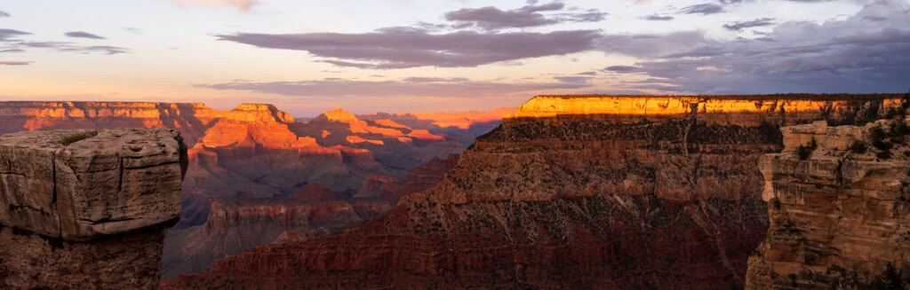
Carved by the Colorado River over an estimated 5 to 6 million years, the Grand Canyon reaches depths of more than 6,000 feet and stretches 277 miles long, a scale genuinely difficult to grasp until you’re standing at the rim looking down into it. This guide walks through the canyon’s two rims, its hiking options, and a genuinely spectacular side trip, checked against real research into each, with practical safety guidance for anyone planning to hike below the rim.
What surprises a lot of first-time visitors is just how differently the North and South Rims are experienced, despite technically overlooking the same canyon. Though only about 10 miles apart as the crow flies, driving between them takes roughly 4-5 hours, since the canyon itself blocks any direct route, and the two rims sit at genuinely different elevations, giving each a distinct climate, vegetation, and visitor experience. That split is worth understanding early, since it shapes almost every other planning decision covered in this guide.
The canyon’s geological story is genuinely as remarkable as its scale, exposed rock layers at the bottom of the canyon date back nearly 2 billion years, roughly 40% of the Earth’s entire history, visible in a single cliff face without needing to dig or drill. That layering, distinct bands of red, orange, and tan rock stacked in a sequence geologists can read like a book, makes the canyon one of the most studied geological formations anywhere on the planet, and even a casual visitor can genuinely appreciate the sheer scale of time represented in the walls surrounding them.
The South Rim
The North Rim
Hiking Into the Canyon
Havasu Falls Side Trip
The Canyon’s Geological Story
South Rim vs. North Rim
Hiking Safety Basics
Best Time to Visit the Grand Canyon
Planning Your Visit
Video: Colorado Hidden Gems
FAQ
The South Rim
Genuinely the more accessible and heavily visited side of the canyon, home to roughly 90% of all park visitors, and the natural starting point for most first-time trips.
Grand Canyon Village & the Rim Trail
The park’s main hub, Grand Canyon Village holds the historic El Tovar Hotel, built in 1905, along with the trailhead for the Rim Trail, a mostly paved, genuinely accessible path running roughly 13 miles along the canyon edge, offering sweeping views without requiring a strenuous hike. Mather Point, just steps from the main visitor center, remains the single most-photographed viewpoint in the entire park, a genuinely reliable first stop for any South Rim visit. The historic Grand Canyon Railway, running from Williams, Arizona directly into the park since 1901, offers a genuinely nostalgic alternative to driving, complete with period-costumed staff and, on some departures, a staged train robbery reenactment.
Grand Canyon Village, South Rim. Park entry fee. Best taking the free shuttle bus system rather than driving, since parking fills up quickly during peak season.

Desert View Watchtower
Designed by architect Mary Colter and completed in 1932, this 70-foot stone tower at the park’s eastern entrance was deliberately built to evoke ancestral Puebloan architectural styles, its interior murals painted by Hopi artist Fred Kabotie, offering genuinely significant Indigenous artistic context alongside sweeping canyon views from its upper observation deck. Colter, one of the few prominent female architects working in the American West during this era, designed several of the South Rim’s most distinctive buildings, and her work genuinely shaped how generations of visitors have experienced the canyon’s built environment.
Desert View, eastern South Rim. Included with park entry. Best combined with a drive along Desert View Drive, which offers several additional overlooks along the way.

The North Rim
A genuinely quieter, higher-elevation alternative, open only for a limited season each year, and rewarding for travelers willing to work around that restricted window.
The North Rim
Sitting roughly 1,000 feet higher than the South Rim, the North Rim’s cooler climate supports a genuinely different ecosystem, dense forests of spruce, fir, and aspen rather than the drier, more desert-adjacent vegetation found across the canyon on the South Rim. Open only from mid-May through mid-October due to heavy winter snowfall, the North Rim draws just a fraction of the South Rim’s visitor numbers, roughly one visitor for every ten who visit the South Rim, offering a genuinely more solitary experience at iconic viewpoints like Bright Angel Point and Cape Royal. The historic Grand Canyon Lodge, its Sun Room offering a genuinely dramatic canyon view through floor-to-ceiling windows, remains the North Rim’s centerpiece and one of the most atmospheric places in the entire park to watch a sunset.
North Rim, open mid-May to mid-October only. Park entry fee. Best for travelers specifically seeking a quieter alternative to the South Rim’s larger crowds.

Hiking Into the Canyon
Genuinely the best way to experience the canyon’s scale, though it demands real respect for the terrain and climate, since a hike into the Grand Canyon reverses the usual logic of mountain hiking entirely, the hard part comes at the end, on the way back up.
Bright Angel Trail & South Kaibab Trail
The two most popular routes down from the South Rim, Bright Angel Trail offers more reliable water sources and shade along its switchbacks, while South Kaibab Trail delivers more dramatic, exposed ridgeline views but genuinely no water access along its length, an important distinction for planning a safe hike. Both trails connect to the Colorado River and Phantom Ranch, the only lodging below the rim, requiring an overnight reservation booked, in many cases, more than a year in advance given genuine demand. Many experienced hikers combine the two trails into a single rim-to-rim or rim-to-river loop, descending via one and ascending via the other, a route that genuinely offers a more varied experience of the canyon’s different rock layers and viewpoints than an out-and-back hike on a single trail.
Trailheads at Grand Canyon Village (Bright Angel) and near Yaki Point (South Kaibab). Included with park entry. Best starting well before sunrise in warmer months, since temperatures below the rim can exceed 100°F by midday.

Havasu Falls Side Trip
A genuinely spectacular detour requiring real advance planning, located within a separate section of the canyon and governed entirely by its own tribal permitting system.
Havasu Falls
Located on Havasupai tribal land within a side canyon of the Grand Canyon, Havasu Falls’ vivid turquoise-blue water, colored by high mineral content, particularly calcium carbonate, cascading over red rock cliffs, has made it one of the most photographed waterfalls in the American Southwest. Reaching it requires a roughly 10-mile hike from Hualapai Hilltop down into Havasu Canyon, and access is strictly limited to travelers holding an advance permit from the Havasupai Tribe, which also requires an overnight stay, day hiking is not permitted, making this a genuinely serious undertaking rather than a casual add-on to a Grand Canyon trip. The Havasupai, whose name translates to “people of the blue-green waters,” have lived in this specific canyon for centuries, and permits, released on a set schedule each year, genuinely sell out within minutes given the site’s extraordinary popularity.
Havasu Canyon, Havasupai Indian Reservation, near the Grand Canyon’s western end. Permit required, booked directly through the Havasupai Tribe, often months in advance. Best planning the trip as its own dedicated multi-day excursion, separate from a standard Grand Canyon National Park visit.

The Canyon’s Geological Story
What makes the Grand Canyon genuinely unique among natural wonders is how completely it exposes the Earth’s own history in a single vertical cross-section. The rock layers visible from any South Rim overlook span nearly 2 billion years, roughly 40% of the planet’s entire 4.5-billion-year existence, from ancient Vishnu Schist at the canyon’s base, among the oldest exposed rock on the continent, up through progressively younger sedimentary layers toward the rim, each band representing a different ancient environment, seafloor, desert, river delta, laid down over unimaginable spans of time. Geologists have long used the canyon as a genuine teaching tool precisely because the sequence is so clearly readable, a single hike from rim to river effectively walks through hundreds of millions of years of Earth’s history in the span of a single day.
The Colorado River itself, responsible for actually carving this exposure over the past 5 to 6 million years, remains a genuinely active geological force today, continuing to deepen and widen the canyon, if imperceptibly on a human timescale. That combination, ancient exposed rock paired with an actively working river, is part of why the Grand Canyon draws serious geologists as readily as casual tourists, few places on Earth offer such a complete, readable record of the planet’s deep past within a single, accessible location, and the canyon’s designation as a UNESCO World Heritage Site in 1979 formally recognized that genuinely unmatched scientific and educational value.
South Rim vs. North Rim
| Category | South Rim | North Rim |
|---|---|---|
| Season | Open year-round | Mid-May to mid-October only |
| Crowds | Roughly 90% of park visitors | Genuinely quieter |
| Elevation | ~7,000 feet | ~8,000 feet, cooler climate |
| Access | Closer to Phoenix and Las Vegas | More remote, longer drive |
For most first-time visitors, the South Rim genuinely makes the most practical choice, its year-round access, greater range of services, and proximity to major airports in Phoenix and Las Vegas make trip planning considerably simpler. The North Rim rewards travelers who’ve already experienced the South Rim, or who specifically prioritize a quieter, more contemplative encounter with the canyon over convenience, its limited season and remote location genuinely filter out much of the crowd that overwhelms South Rim viewpoints during peak summer months.
Hiking Safety Basics
The Grand Canyon’s below-rim temperatures genuinely differ dramatically from the rim itself, often 20 degrees or more hotter at the canyon floor, a real hazard that catches unprepared hikers off guard every year, and the park service genuinely responds to hundreds of heat-related rescues annually, most involving hikers who underestimated the return climb. The National Park Service strongly advises against attempting to hike to the river and back in a single day, recommending instead an overnight stay at Phantom Ranch or a backcountry campsite, since the climb back out genuinely takes far longer and demands more energy than the descent, a fact that surprises many first-time canyon hikers used to trails where the uphill portion comes first.
Carrying significantly more water than feels necessary, and eating salty snacks to help maintain electrolyte balance, are both genuinely essential practices given how quickly dehydration and heat exhaustion can develop in the canyon’s dry, exposed terrain, a hiker descending into the canyon in summer heat can lose several liters of fluid through sweat in just a few hours. Starting any serious hike well before sunrise during warmer months, and turning back before reaching a planned turnaround point if conditions feel off, are both habits genuinely worth adopting rather than pushing through discomfort in pursuit of a specific destination, since the canyon’s remoteness means help, if needed, is never quick to arrive.
Best Time to Visit the Grand Canyon
Spring (March-May) and fall (September-November) offer the most comfortable temperatures for hiking on both rims, avoiding summer’s genuine extreme heat, particularly dangerous for anyone hiking below the rim, where temperatures can climb well past 100°F even as the South Rim itself stays comfortably in the 80s. Summer remains the most popular season for rim-only sightseeing despite the heat, since the South Rim’s elevation keeps temperatures at the viewpoints themselves genuinely more bearable than the canyon floor below, and long daylight hours make it a genuinely convenient season for families traveling during school break.
The North Rim closes entirely from mid-October through mid-May due to heavy snowfall, a genuinely important planning detail for anyone specifically hoping to visit that side of the canyon, since arriving outside this window means finding the entrance road gated and impassable. Winter brings snow to the South Rim as well, though it remains open year-round, offering a genuinely striking, less crowded version of the canyon for travelers willing to brave colder temperatures, snow dusting the canyon’s red rock layers creates a color contrast found at no other time of year.
Planning Your Visit
Advance reservations genuinely matter for nearly every part of a Grand Canyon trip beyond simply showing up at a rim overlook. Lodging inside the park, whether at Grand Canyon Village on the South Rim or the Grand Canyon Lodge on the North Rim, books out months in advance for peak summer dates, and even the free backcountry campsites below the rim require a permit obtained through a competitive lottery-style process during the busiest parts of the year. Mule rides into the canyon, a genuinely popular alternative for visitors who want the below-rim experience without hiking it themselves, also require booking well ahead, sometimes over a year out for the most popular departure dates. Building in this kind of lead time, rather than assuming spontaneous access will be available, genuinely makes the difference between a smooth trip and a frustrating one at a park this popular.
Watch: 25 Hidden Gems in Colorado
Building a longer Southwest road trip around the canyon? Our video guide to 25 hidden gems in Colorado, from Great Sand Dunes National Park to Mesa Verde, makes a natural next stop.
If this guide helped you plan your Grand Canyon trip, check out more travel videos from Worldly Traveler.
Whichever rim or trail ends up on your itinerary, the Grand Canyon genuinely rewards a visit built around respect for its scale rather than an attempt to conquer it in a single rushed day. A canyon carved over millions of years, and rock layers exposed from nearly the dawn of the planet itself, isn’t really a place meant to be checked off a list, it’s somewhere that genuinely benefits from slowing down, whether that means a full sunset at a quiet North Rim overlook or simply sitting at Mather Point long enough to watch the light shift across the canyon walls.
Frequently Asked Questions
Should I visit the South Rim or North Rim of the Grand Canyon?
The South Rim is open year-round, more accessible, and holds roughly 90% of park visitors, while the North Rim, open only mid-May through mid-October, offers a quieter, higher-elevation experience with genuinely fewer crowds.
How deep is the Grand Canyon?
The Grand Canyon reaches depths of over 6,000 feet (about 1,800 meters) at its deepest point, carved by the Colorado River over an estimated 5 to 6 million years.
How far is Havasu Falls from the Grand Canyon?
Havasu Falls sits within a separate section of the canyon on Havasupai tribal land, reached via a roughly 10-mile hike from Hualapai Hilltop, a genuinely demanding trek requiring an advance permit from the Havasupai Tribe.
Can you hike to the bottom of the Grand Canyon in one day?
The National Park Service strongly advises against attempting a rim-to-river-to-rim hike in a single day due to the genuine physical demands and heat risk, recommending an overnight stay at Phantom Ranch or a backcountry campsite instead.
What is the best time of year to visit the Grand Canyon?
Spring (March-May) and fall (September-November) offer the most comfortable temperatures for hiking, while summer brings extreme heat, especially below the rim, and the North Rim closes entirely from mid-October through mid-May.