
The United States holds 63 national parks, and while some sit isolated enough to require their own dedicated trip, several regions genuinely cluster multiple parks close enough together to link into a single, well-paced road trip. This guide ranks the best national park road trip loops in the country, organized by region, checked against real research into driving distances, crowd patterns, and seasonal access, with practical logistics for making the most of any of these routes.
What makes a genuinely good national park road trip loop isn’t simply proximity, some parks sit close together on a map but require crossing genuinely difficult terrain or seasonal road closures that make a direct route impractical for much of the year. The three loops covered in this guide were selected specifically because they combine real geographic proximity with reliable road access and, crucially, a genuine variety of landscape from one park to the next, since driving hours between two visually similar parks rewards the effort far less than a loop that keeps delivering something new.
Planning a multi-park road trip also genuinely benefits from thinking in terms of a loop rather than a straight line whenever the geography allows it, a circular route avoids backtracking over already-seen roads and often opens up the option of starting and ending at the same major airport, simplifying flight logistics considerably. Each of the three regions covered below offers exactly that kind of loop structure, letting a road trip build naturally from one park’s landscape into the next without doubling back on itself.
The Southwest Loop
The Rocky Mountain Loop
The Pacific Coast Loop
Matching Each Loop to the Right Season
Ranking the Parks by Scenery & Crowds
Road Trip Logistics
Vehicle & Packing Considerations
FAQ
The Southwest Loop
Genuinely the most popular multi-park road trip in the country, connecting Utah’s five national parks along with the Grand Canyon just across the Arizona border, all within a landscape defined by red rock, deep canyons, and desert light.
Utah’s Mighty 5
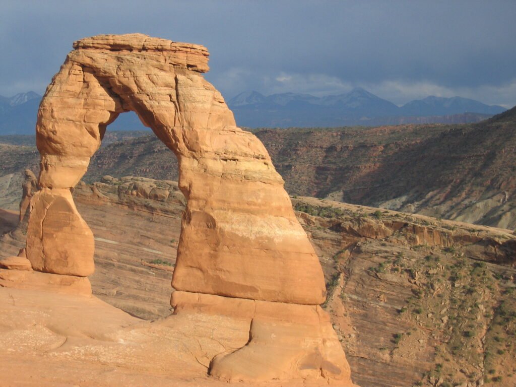
Zion, Bryce Canyon, Capitol Reef, Canyonlands, and Arches together form what Utah’s tourism board has branded the “Mighty 5,” a loop covering roughly 700 miles of driving connecting five dramatically different desert landscapes, from Zion’s towering canyon walls to Bryce’s hoodoo amphitheater to Arches’ more than 2,000 documented natural stone arches, the highest concentration found anywhere in the world. Capitol Reef, genuinely the least visited and most overlooked of the five, holds a 100-mile geological wrinkle in the Earth’s crust called the Waterpocket Fold, along with a historic orchard planted by 19th-century Mormon settlers, still maintained today and open for visitors to pick fruit in season. Canyonlands, split into distinct, hard-to-connect districts by the Colorado and Green Rivers, rewards visitors with genuinely dramatic overlooks at Island in the Sky, requiring far less driving than its size on a map might suggest to properly appreciate.
The route between these five parks also passes through genuinely worthwhile towns and scenic byways that reward slowing down rather than rushing between park entrances, Moab, the gateway to both Arches and Canyonlands, has developed into a genuine hub for outdoor recreation beyond the parks themselves, offering mountain biking and rafting on the Colorado River as worthwhile detours for travelers with extra time to spare. Scenic Byway 12, connecting Bryce Canyon toward Capitol Reef, is itself considered one of the most beautiful drives in the entire country, regularly appearing on lists of America’s best scenic roads independent of the national parks it happens to connect.
Southern and eastern Utah. Individual park entry fees or an annual pass. Best allotting 10-14 days for the full loop, given the genuine driving distances between the more remote parks like Capitol Reef and Canyonlands.
The Rocky Mountain Loop
A genuinely high-altitude alternative to the desert Southwest, connecting Colorado’s premier national park to Wyoming’s volcanic wonderland, a route defined by elevation and alpine scenery rather than red rock and canyon light.
Rocky Mountain National Park & Yellowstone/Grand Teton
Rocky Mountain National Park’s Trail Ridge Road, reaching 12,183 feet, holds the genuine distinction of being the highest continuous paved highway in the entire United States, with roughly 11 miles of the route running above treeline through genuine alpine tundra, a landscape and climate more typically associated with the Arctic than the continental US, conditions on the road can shift from summer warmth to near-freezing wind within the span of a single drive. Driving north from Colorado into Wyoming connects to Grand Teton National Park, its jagged peaks rising dramatically without the foothills that soften most other mountain ranges, a genuinely striking visual effect that makes the Tetons look taller and more dramatic than their actual elevation might suggest relative to nearby ranges. From there, the route continues to Yellowstone itself, covered in more depth in this site’s dedicated Yellowstone guide, completing a loop that showcases both alpine tundra and geothermal wonder within a single extended road trip. The full drive between Rocky Mountain National Park and the Yellowstone/Grand Teton area passes through genuinely varied Wyoming landscape, high desert basin country giving way to increasingly dramatic mountain scenery as the route approaches Jackson Hole, itself worth a stop for its own genuine Western character and access to world-class skiing in winter months.
Colorado to Wyoming, roughly 300-350 miles one way between Rocky Mountain National Park and Yellowstone. Individual park entry fees or an annual pass. Best in July or August, since Trail Ridge Road’s high-elevation sections typically remain closed by snow well into early summer.

The Pacific Coast Loop
Connecting California’s dramatic granite wilderness with the tallest trees on the planet, this loop offers a genuinely different pace and landscape from either of the desert or alpine routes covered above.
Yosemite, Sequoia & Kings Canyon
Yosemite, covered in more depth in this site’s dedicated guide, anchors the northern end of this loop, connecting via a roughly 5-6 hour drive to Sequoia and Kings Canyon National Parks, technically managed as a single unit and home to General Sherman, the largest tree on Earth by volume, standing at over 274 feet tall with a trunk circumference exceeding 100 feet. The drive between the parks, while genuinely long by road trip standards, passes through California’s Central Valley agricultural heartland, a real contrast to the granite wilderness on either end of the journey, and a reminder of just how much the state’s landscape shifts within a relatively short driving distance. Kings Canyon itself, often overshadowed by its more famous neighbor Sequoia, holds genuinely dramatic granite canyon scenery rivaling Yosemite’s own valley, carved by the Kings River to depths exceeding those of the Grand Canyon at certain points along its length, a detail that surprises many visitors who’ve never heard of the park before planning this specific route, and one worth actively seeking out rather than treating as a minor add-on to the more famous Sequoia stop.
Central California. Individual park entry fees or an annual pass. Best in summer, when high-elevation roads and trails in all three parks are fully accessible.
Matching Each Loop to the Right Season
Timing genuinely matters more for a multi-park road trip than for a single-destination visit, since each loop covers a range of elevations and climates that don’t necessarily share the same ideal season. The Southwest Loop’s desert parks are best tackled in spring or fall, when daytime temperatures stay comfortable for hiking, summer heat across southern Utah can genuinely become dangerous for anything beyond a short, early-morning walk, particularly in Canyonlands and Arches, where shade is scarce along most trails. The Rocky Mountain Loop, by contrast, is genuinely constrained to a narrower summer window, Trail Ridge Road typically doesn’t fully open until late May or June and can close again as early as October, meaning the loop’s highest-elevation highlight is only accessible for a few months each year.
The Pacific Coast Loop offers the most seasonal flexibility of the three, Yosemite’s valley floor remains accessible year-round even as its own high country closes in winter, though visiting Sequoia and Kings Canyon’s higher elevations still benefits from the same summer window as the other mountain-heavy routes. Cross-referencing each park’s specific road and trail closure schedule before finalizing travel dates is genuinely worth the extra research time, since assuming a park operates identically year-round is one of the most common planning mistakes travelers make when stringing together a multi-park itinerary.
Ranking the Parks by Scenery & Crowds
| Park | Scenery Rating | Crowd Level | Best For |
|---|---|---|---|
| Zion | Exceptional, dramatic verticality | Very high, shuttle required | Immersive canyon hiking |
| Bryce Canyon | Exceptional, genuinely unique | High but more manageable | Sunrise viewpoints |
| Arches | Exceptional, dense arch concentration | Very high, timed entry required | Photography, short hikes |
| Capitol Reef | Excellent, genuinely underrated | Low, a real hidden gem | Solitude, historic orchards |
| Canyonlands | Excellent, vast scale | Moderate | Overlooks, backcountry access |
| Rocky Mountain NP | Exceptional, alpine tundra | High, timed entry required | High-altitude scenic driving |
Capitol Reef genuinely stands out on this list as the most underrated stop across all three loops, its combination of dramatic geology and genuinely thin crowds makes it a favorite among repeat national park visitors who’ve grown weary of the more famous parks’ parking lot congestion and long trailhead waits. Arches and Zion, by contrast, have both implemented timed entry systems in recent years specifically because visitor numbers began outpacing the parks’ physical infrastructure, a genuine sign of these parks’ enduring popularity but also a real planning consideration that wasn’t necessary even a decade ago.
Road Trip Logistics
Purchasing an America the Beautiful annual pass genuinely pays for itself on any road trip covering more than three or four national parks, a single flat fee covering entry to every national park and most other federal recreational land for a full year, rather than paying individual entrance fees at each stop, the pass typically pays for itself after visiting just three parks charging a standard per-vehicle fee. Several of the parks covered in this guide, including Rocky Mountain, Arches, and Zion, now require timed entry reservations during the busiest peak season months, a genuinely essential detail to check and book well in advance, since these systems have increasingly become standard practice at the country’s most visited parks to manage overcrowding, and reservation windows for the most popular time slots can fill within minutes of opening.
Cell service genuinely disappears for long stretches between many of these parks, particularly across rural Utah and Wyoming, making offline maps and a physical backup plan for navigation a genuinely worthwhile precaution rather than relying entirely on a phone, downloading offline map sections before setting out each day is a simple habit that avoids real frustration in areas where a wrong turn could mean an hour of backtracking with no way to check a live map. And building in more time than feels strictly necessary between stops, rather than planning a tightly scheduled itinerary, accounts for the reality that road trip driving times in mountainous or high-elevation terrain often run longer than a map’s estimate suggests, especially in areas prone to sudden weather changes, a mountain pass that looks like a quick 40-minute drive on paper can easily become two hours if snow, wildlife, or simply the urge to pull over for a viewpoint enters the equation.
Vehicle & Packing Considerations
A standard sedan genuinely handles the vast majority of roads across all three loops in this guide, since the main routes through each park system are fully paved, but several worthwhile side roads and viewpoints, particularly in Canyonlands and parts of Capitol Reef, require a high-clearance or four-wheel-drive vehicle to reach safely. Checking each specific destination’s road requirements before setting out, rather than assuming a rental sedan can handle every route, avoids both safety risks and the genuine disappointment of turning back from a planned stop. Packing for temperature swings matters more on these road trips than travelers often expect, desert parks can shift from warm afternoons to genuinely cold nights, while the Rocky Mountain loop’s high-elevation stretches can bring freezing temperatures even in the middle of summer. A basic emergency kit, extra water, a paper map as backup, and a portable phone charger, is worth carrying regardless of which loop you choose, given how remote some stretches of driving genuinely are between fuel stops and cell coverage.
If this guide helped you plan your national park road trip, check out more travel videos from Worldly Traveler.
Whichever loop ends up on your itinerary, the real appeal of a national park road trip lies in the transitions as much as the destinations themselves, watching Utah’s red desert give way to Colorado’s alpine tundra, or California’s granite peaks descend into the world’s tallest trees, delivers a sense of scale and variety that a single-park trip simply can’t match. Building in flexibility, extra time at the parks that surprise you, less time at the ones that don’t, genuinely matters more than sticking rigidly to a planned schedule, since some of the best moments on a trip like this come from an unplanned stop at a pullout that wasn’t even on the map beforehand.
Frequently Asked Questions
What is the best national park road trip in the US?
Utah’s “Mighty 5” loop, connecting Zion, Bryce Canyon, Capitol Reef, Canyonlands, and Arches, is genuinely one of the most popular and rewarding national park road trips in the entire country, offering five dramatically different landscapes within a manageable driving distance.
What is the highest paved road in the United States national park system?
Trail Ridge Road in Rocky Mountain National Park, Colorado, reaches an elevation of 12,183 feet, making it the highest continuous paved highway in the country, with roughly 11 miles running above the treeline through genuine alpine tundra conditions.
How many national parks can you see in one road trip?
A well-planned 10-14 day road trip can realistically cover 4-5 national parks within a single region, such as Utah’s Mighty 5 or a Pacific Coast loop connecting Yosemite, Sequoia, and Kings Canyon, without feeling rushed at any single stop.
What is the best time of year for a national park road trip?
Late spring through early fall offers the widest access to high-elevation roads and trails across most national park regions, though shoulder seasons (May and September) generally offer a genuinely better balance of open facilities and thinner crowds.
Do I need a separate entrance fee for each national park?
Not if you purchase an America the Beautiful annual pass, which covers entry to all US national parks and federal recreational lands for one flat fee, genuinely worth it for any road trip covering more than three or four parks over a full year.